 Biking
 Login
Login More
More EN
EN Premium
Ovelo - Out and about in the upper Our valley
44.5 km • Schönberg
 official route
5082 0 0/5
 Addresse starting point (approximate)
N626, 4780 Schönberg
 signage
The route is fully signposted with nodes.
 Description
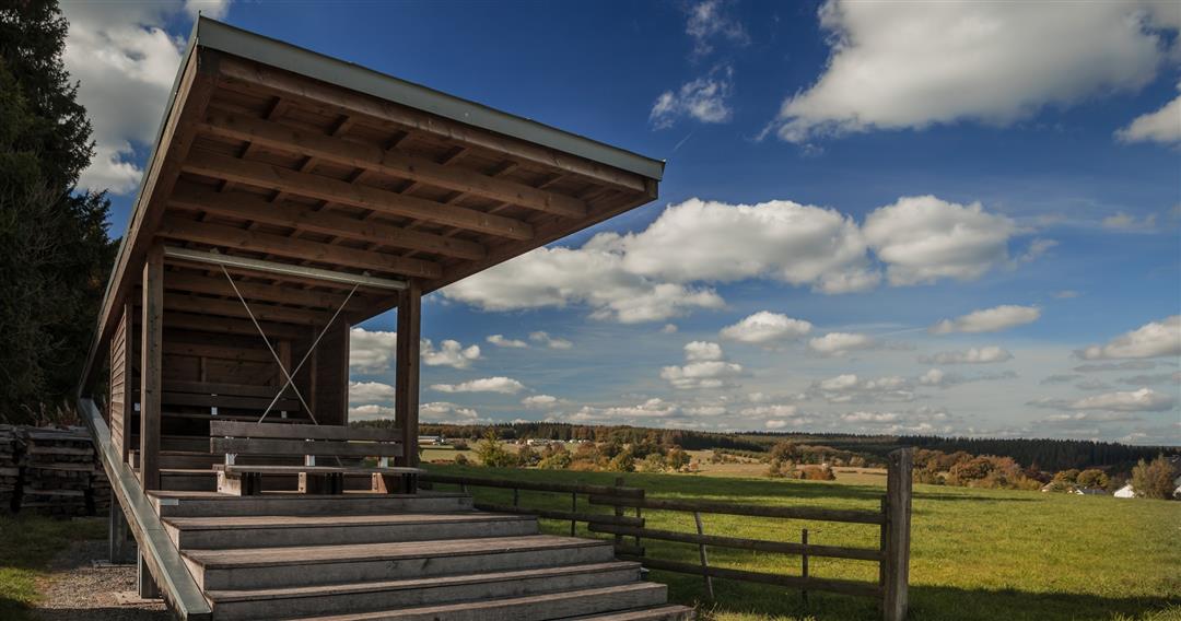
The 9-kilometre ride takes you alongside the watershed between the Maas and Moselle-Rhine basin near the German border. This is the source of the Our, which you will be following for a bit on German territory. There are at least three locations along the way from which you can enjoy a stunning view of the highest hills and deepest valleys of the region. In Herresbach, for instance, the wooden platform “Wood Eye” looks out over the sprawling Our valley, and on the horizon you can see the large number of wind turbines on the German side. In Heppenbach, on the “Maas side”, you are close to the source of the Amel. Some clusters of small houses along the way await you with the simplistic and homely flair of quaint villages. Krewinkel in particular is worth stopping off at. The houses are widely scattered and have been renovated in keeping with the architecture typical of the village. In the centre of the village stands a simple Gothic church, which was erected at the beginning of the 16th century and is dedicated to St. Eligius, the patron saint of blacksmiths and metalworkers. This is certainly no coincidence, as iron ore was excavated in many places towards the end of the Middle Ages.
Junction nodes : 41 > 42 > 15 > 14 > 09 > 03 > 06 > 28 > 27 > 26 > 24 > 23 > 18 > 12 > 16 > 41
 nodes to follow
0 km
0.1 km
2.8 km
3.1 km
8.9 km
11 km
13.6 km
19 km
20.8 km
25.7 km
28.1 km
28.2 km
28.3 km
28.9 km
34.9 km
35 km
37.8 km
41.1 km
44.6 km


 Upgrade to Premium Plus
